What happened
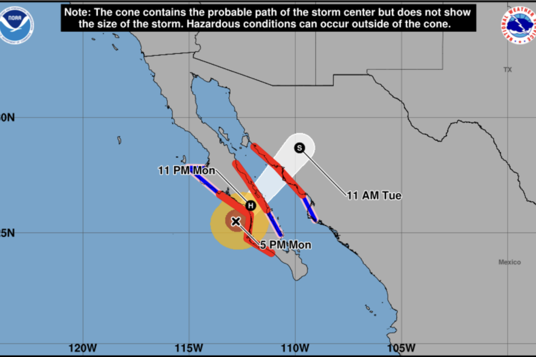
Hurricane Polo made landfall in Mexico as a Category 3 hurricane, bringing catastrophic winds, rain, and surf to the southern half of Baja California. The storm had maximum sustained winds of 115 mph and was expected to cross the Gulf of California and move into the Mexican state of Sonora.
The National Hurricane Center reported that the center of Polo was about 60 miles northwest of Cabo San Lazaro, moving northeast at 12 mph. Hurricane warnings were issued for both coastlines of Baja California and the western coast of mainland Mexico.
The storm was expected to make a second landfall in mainland Mexico, with rapid weakening forecast for Tuesday as it moves inland. Life-threatening winds and flash flooding were ongoing, with a storm surge expected to produce significant coastal flooding in areas of onshore winds.
Rainfall amounts of six to 12 inches were expected for Baja California, and eight inches for mainland Mexico through September 29. The remnants of Polo are expected to continue moving northeast across the border and into the American Southwest, with a wind advisory issued for parts of New Mexico and Western Texas.